The thought of visiting Death Valley National Park in the summer has never appealed to me. Death Valley is the largest National Park in the 48 contiguous United States. It also encompasses the lowest point below sea level in North America, Death Valley is also the driest and hottest place in North America. In the Valley itself, also known as Badwater Basin, summer temperatures regularly exceed 130 degrees Fahrenheit (55 Celsius.)
The mean maximum daytime temperatures in Death Valley in July hover around 126F (53C.) The highest temperature recorded in Death Valley is 134F (57C.) Willingly going into that frying pan – especially on foot – is crazy.
Cooler temperatures make the winter season by far the best time to visit Death Valley. The average high temperature in January is in the high to mid 60s (20C,) and the average low is in the low 40s (6C) and sometimes dips to the upper 30s. In February, the average high is 74F (23C) and the average low is 49F (9C.)
Death Valley is a driving park. The distances on the scenic drive through the park are great and the roads are often curvy and steep. And you'll spend a lot of time in the car. Services are few and far between, so visitors are advised to fill up their gas tanks and several water bottles before entering the park, and to continue to keep an eye on the gas needle and your water levels.
There are plenty of hikes into the park at various spots along the road, and the winter months are a great time to do them. Although it's cold in the morning, as is any desert, in January it warmed up nicely into the low 70s and made for perfect conditions for hiking. It is invariably sunny, though, so be sure to bring a hat and sun screen for your outdoor activities.
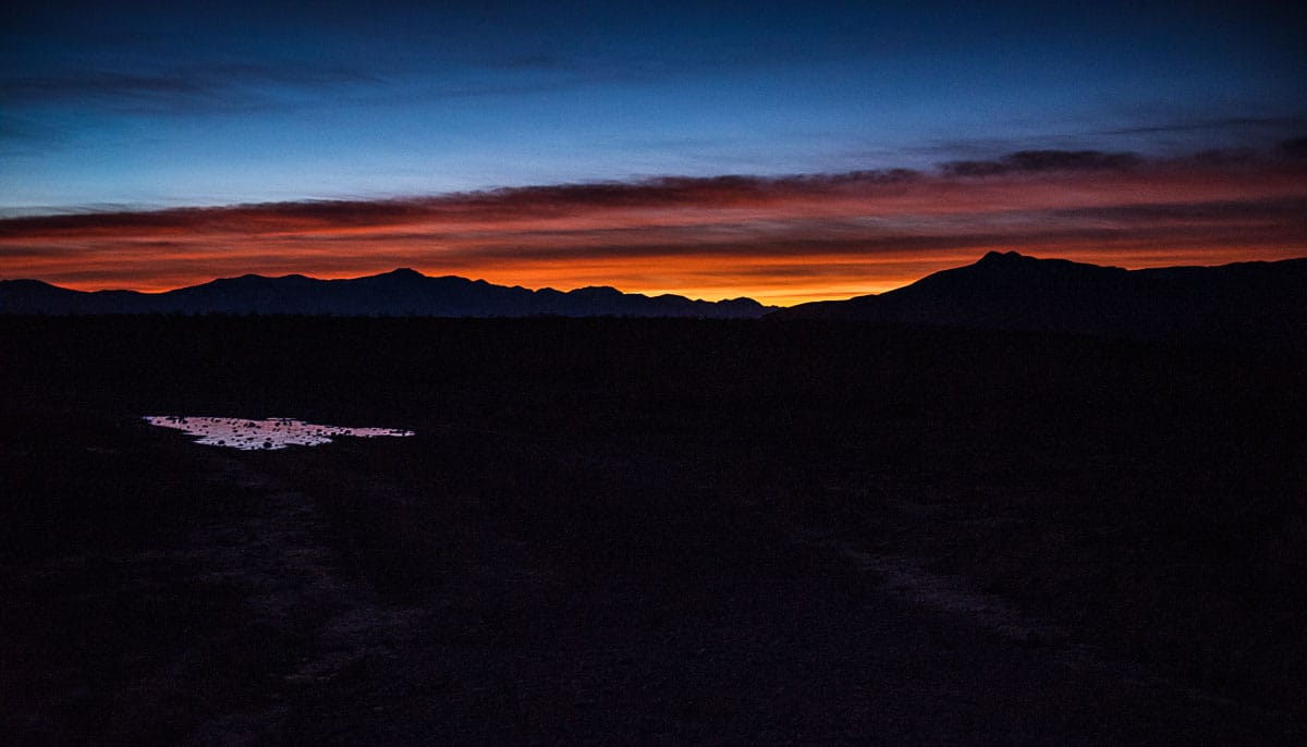
Table of Contents
Things to do in Death Valley National Park
Your first stop should be the Furnace Creek Visitor Center to get detailed driving and hiking maps of the park. And, be sure to actually talk to the always knowledgable park rangers about activities that will fit your level of interest and fitness.
Also recommended is spending a little on the National Geographic detailed map of the Park. Also, we found the Falcon Guide Best Easy Day Hikes in Death Valley very useful. You can buy them in a package together at the Park's Visitor's Center.
While you're at Furnace Creek, too, it's a short drive to the historical Harmony Borax Works and Twenty Mule Team Canyon, if you are interested in the mining history of Death Valley.
The Father Crowley Vista
The Father Crowley Vista is just inside the west entrance to the Park and is probably the first signpost you'll see if you enter from that direction. We got to the Park in the early afternoon, which is the time that any photographer will tell you is not exactly prime time for a good photo. So, we got out of the car, looked out over the designated vista, and got back in the car and moved on.
However, I made a note to come back to the vista early the next morning. Although the sun rise was in the opposite direction of the vista, I suspected the surrounding mountains would provide a nice frame for the sunrise. Now, if only the clouds would cooperate. The results are in the photo above.
Zabriskie Point
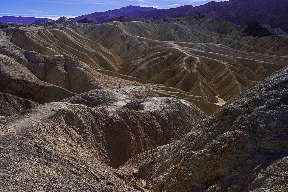
The famous Zabriskie Point is on the east side of the Park, nearly exactly opposite the Father Crowley point. This would have made a great early morning photo perhaps, but was at least an hour's drive from where we were staying. The viewpoint near the road overlooks the Furnace Creek rock formations, and the stark badlands landscape is one that does show itself well in bright sunlight. If you like, you can hike down a ways into the area or start the hike around Badlands Loop. Connector trails lead to Golden Canyon, Gower Gulch, and Red Cathedral.
Mesquite Flats Sand Dunes
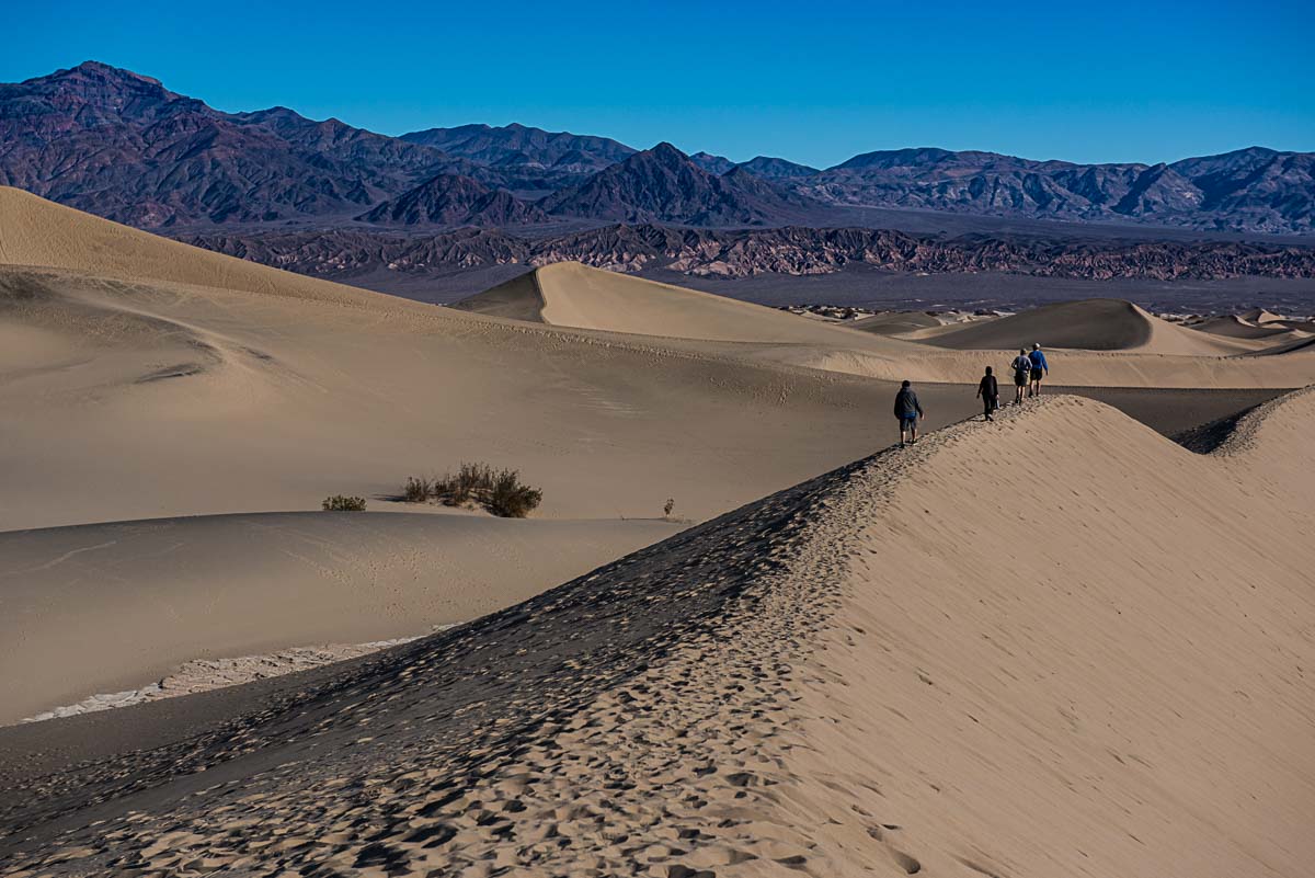
The Mesquite Flats Sand Dunes are an interesting, but a bit difficult, walk. There are no paths into the dunes so if you want to get back to the more pristine and higher dunes, you'll be walking half an hour through the deep sand. It's not necessarily rugged terrain, but it will provide a workout, especially when you climb the higher dunes. But the further you go back, the fewer footprints of other hikers you'll find. Go all the way back from the trailhead to the top of the last dunes, and there are almost none.
The Ubehebe Crater
The Ubehebe Crater in the north part of the park, formed about 2000 years ago when rising magma hit a pocket of water and caused an explosion that dug out a crater about 800 feet deep. The crater can be reached by a short walk from the road. There's a path the circles the crater, if you want a longer walk.
Artist's Palette Drive
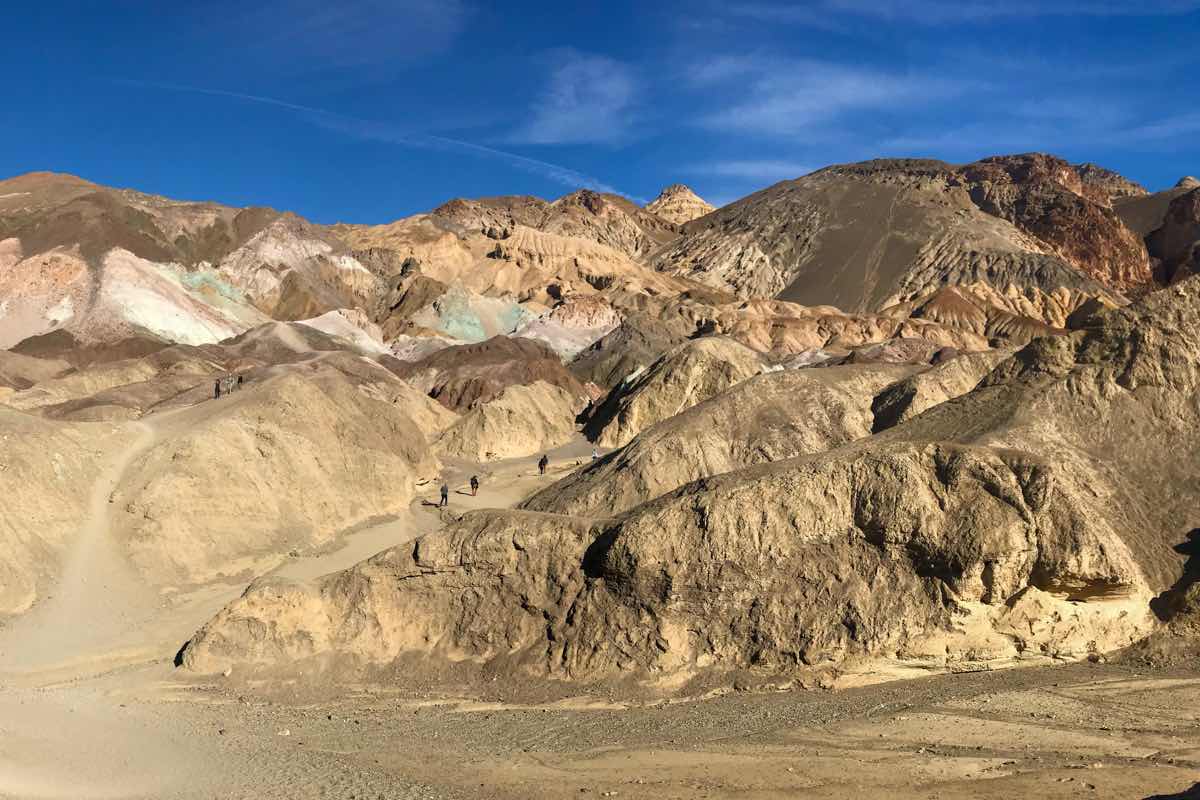
The so-called Artist's Palette Drive is a one-way drive just off Highway 190 on the east side of the park. You can get out of the car and take a hike into the area on a 4.5 mile loop. Or you can just do the drive and admire the subtle change of colors.
Badwater Basin
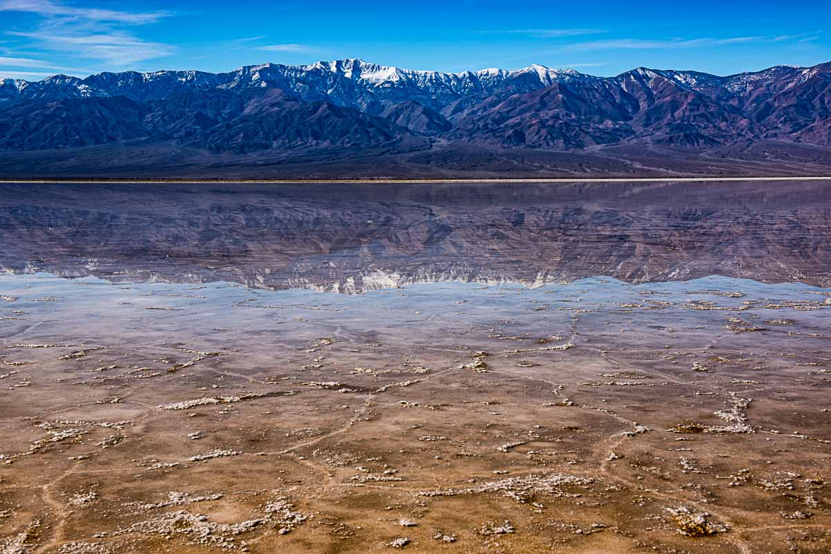
Badwater Basin is the actual name for Death Valley. Being there in the winter means you'll get to see it with a little bit of water in it if you're willing to walk a mile or so from the parking lot. And, if there's water, there can be an amazing reflection of the Amaragosa Mountains to the east.
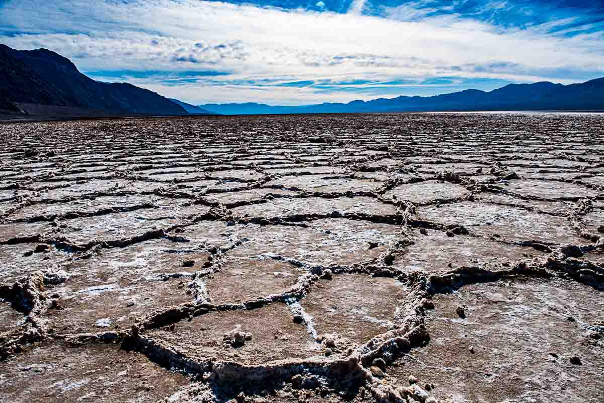
If you do walk out onto the flats, you'll also get a view of the process of rain and evaporation that leaves a pattern of rough hexagonal salt ridges like the ones visible in the photo at the top of this post. A fascinating process really, and one you can't get a true sense of unless you visit in winter. In the summer, you'll get a sense of how hot the world can get, as the Badwater Basin is the hottest part of the Park.
Aguereberry Point
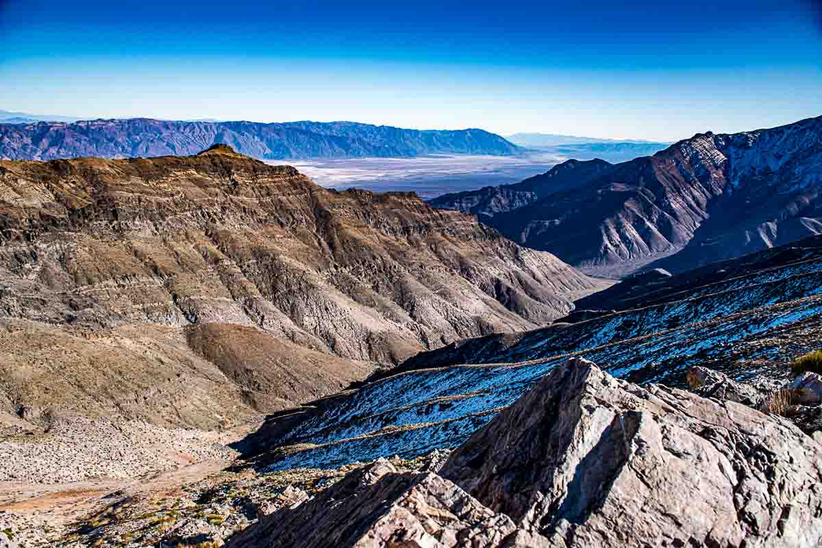
Aguereberry Point, one of the higher elevations of the park that you can reach by car, was our destination of choice to get a panoramic view over the Badwater Basin. Dante's View is generally regarded as the premier view, but it was closed because of the snow in the mountains. We were assured by a park ranger that Aguereberry Point, although actually higher than Dante's View, was open. And it would have been to an all-wheel drive car. Unfortunately, our rented SUV was only front-wheel drive.
I specifically asked for an SUV when we made the rental reservations because I knew we'd be in for a little rough terrain in Death Valley. In Minnesota, where we're from, an SUV by default is all-wheel drive, because, well, we have lots of snow in Minnesota. So I never thought to check when we picked up the car. I just (stupidly) presumed.
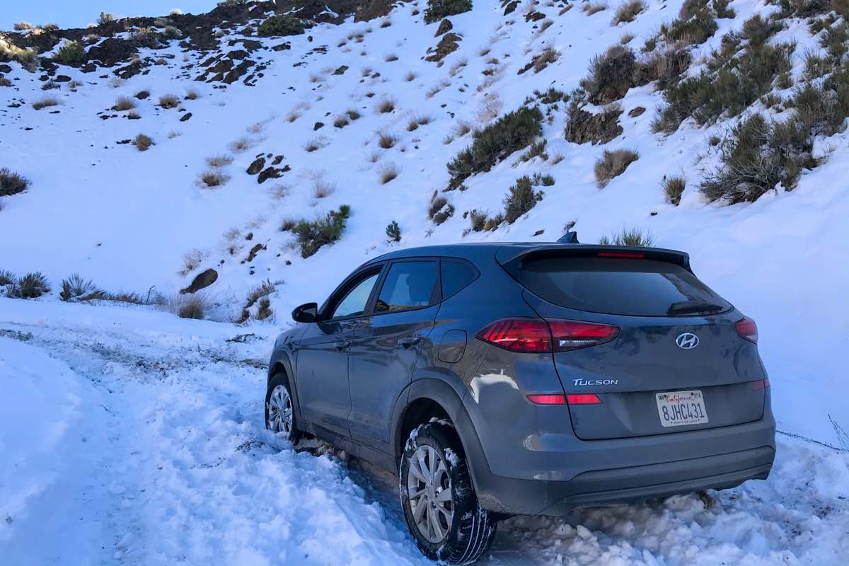
As we were climbing up the mountain pass and began to do a little sliding around, I asked Kris to check the owner's manual to see if we were in an all-wheel drive, and she had just got the book out of the glove compartment when we hit some deeper snow and stuck. And, of course this being a California car, there was no snow equipment, or even a scraper, we could use to dig ourselves out. We hiked a bit up the road, only about 30 feet actually, and were able to bring back laundry bags full of gravel to put under the wheels. We succeeded after an hour's effort of moving the car about ten feet, and were stuck fast still. Of course, there's no cell signal anywhere in the Park you could use to summon help.
Luckily, another car finally came up the road, and a very nice guy named Graham from Wales helped us with our predicament. All we managed to do was slide the car further down the road, into more snow, as the result of another hour's work.
Then, we got even luckier when Johnny and Michelle showed up in a serious four-wheel drive truck. And Johnny happened to be carrying actual traction pads. Between the traction pads and three men pushing we finally got the car unstuck. We drove it back down the hill a ways to where we could park it off the road facing downhill.
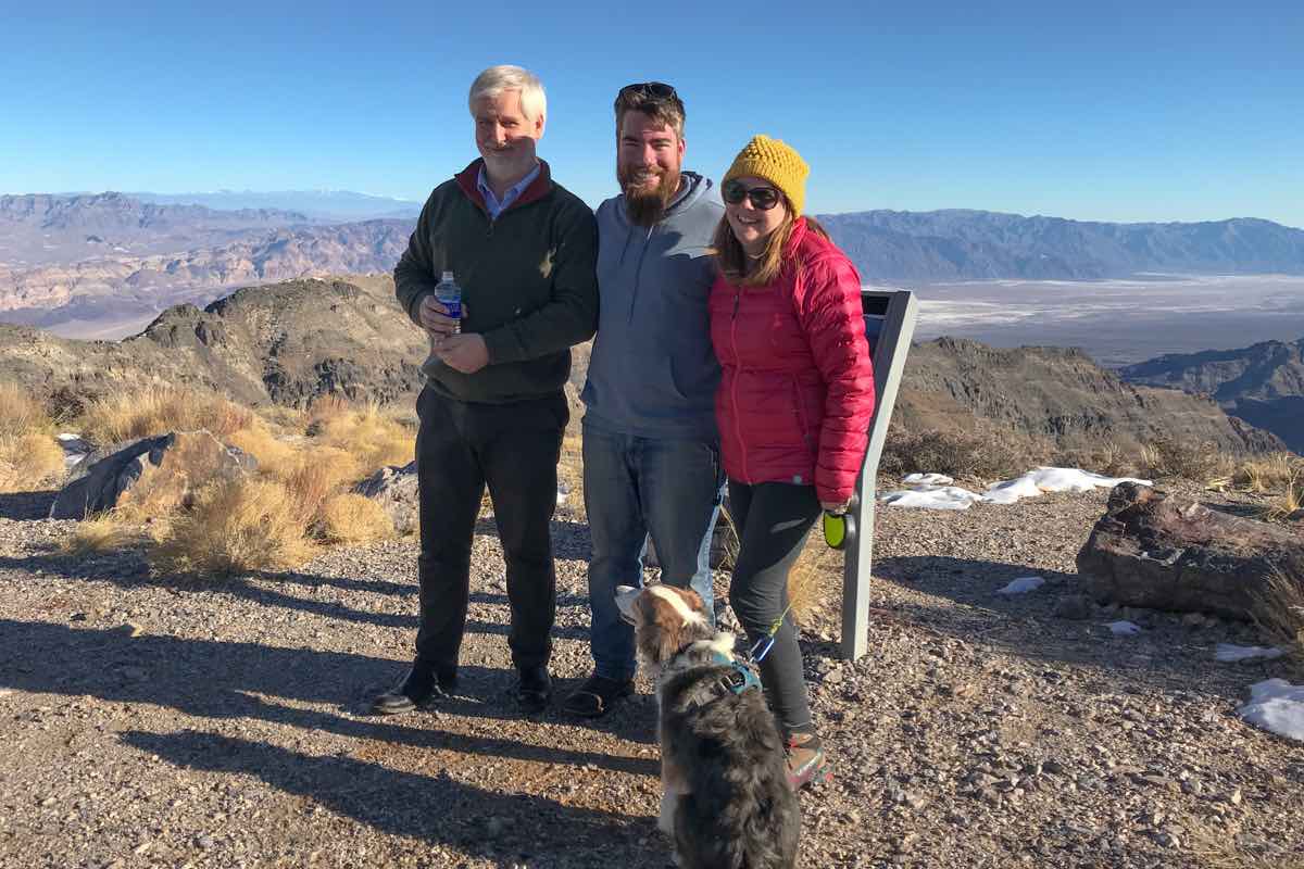
Then, Kris and I joined Graham in his all-wheel car, and we easily motored up the rest of the way to the amazing overlook, staying close to Johnny and Michelle, convoy style. I have to say, it was worth the trouble.
How to get to Death Valley
If you're flying into the area specifically to see Death Valley National Park, Las Vegas is the closest major city. From Las Vegas, the park is about a two-hour drive. From Los Angeles, the park is more than a six-hour drive away.
Where to stay in Death Valley National Park
Panamint Springs Resort – Panamint Springs is where we stayed. It's just about ten miles inside the west entrance to the Park on Highway 190. The Panamint Springs Resort is a pretty generous appellation. There's not much of what you'd think makes up a resort there. What there is is a motel with standard small rooms, a bar/restaurant that serves excellent chili and burgers sort of fare, and breakfast, and a general store and gas station. All you need– especially if you're like us and spend minimal time in the room. Get up, eat, fill the water bottles, and hit the road. This is the place for that. And, by the way, it's by far the cheapest lodging in the Park. Another thing about Panamint that needs mentioning is that the staff was perhaps the nicest people we've run into in a long time. From the guy at the General Store who checked us in, to the wait staff in the bar and restaurant, they all made us feel very welcome.
The Inn at Death Valley – Inside the Park The Inn at Death Valley is pretty much the opposite of the Panamint Springs Resort. We didn't see any of the rooms, but we did stop into the restaurant for lunch one day. (It happened to be near where we were.) A hamburger was $21 and a beer was $10, if that gives you any ideas of the place. Last time I checked, the rooms were around $500 per night, which was about four times the rate at Panamint. If you're going to Death Valley to swim in the pool, this is the place for you.
The Ranch at Death Valley – Inside the Park All we can say about The Ranch is that it's priced about half of The Inn, which still makes it twice as much as Panamint Springs. I'm sure it's nicer. If you're not into the “rustic” feel of Panamint Springs, this might be the choice for you.
For more lodging options, check out vacation rentals in Death Valley on cozycozy, where you can compare and book a range of accommodations to suit your trip.
Death Valley National Park is part of the US National Park system. See this post for a list of all US National Parks sites, with links to stories about the ones we've visited.
Up Your Travel Skills
Looking to book your next trip? Use these resources that are tried and tested by us. First, to get our best travel tips, sign up for our email newsletter. Then, be sure to start your reading with our Resources Page where we highlight all the great travel companies and products that we trust. Travel Accessories: Check out our list of all the accessories we carry to make getting there and being there a lot easier. Credit Cards: See our detailed post on how to choose the right travel rewards credit card for you. Flights: Start finding the very best flight deals by subscribing to Thrifty Traveler. Book your Hotel: Find the best prices on hotels with Booking.com. See all of the gear and books we like in one place on our Amazon shop.Got a comment on this post? Join the conversation on Facebook, Instagram, or Threads and share your thoughts!


Comments are closed.