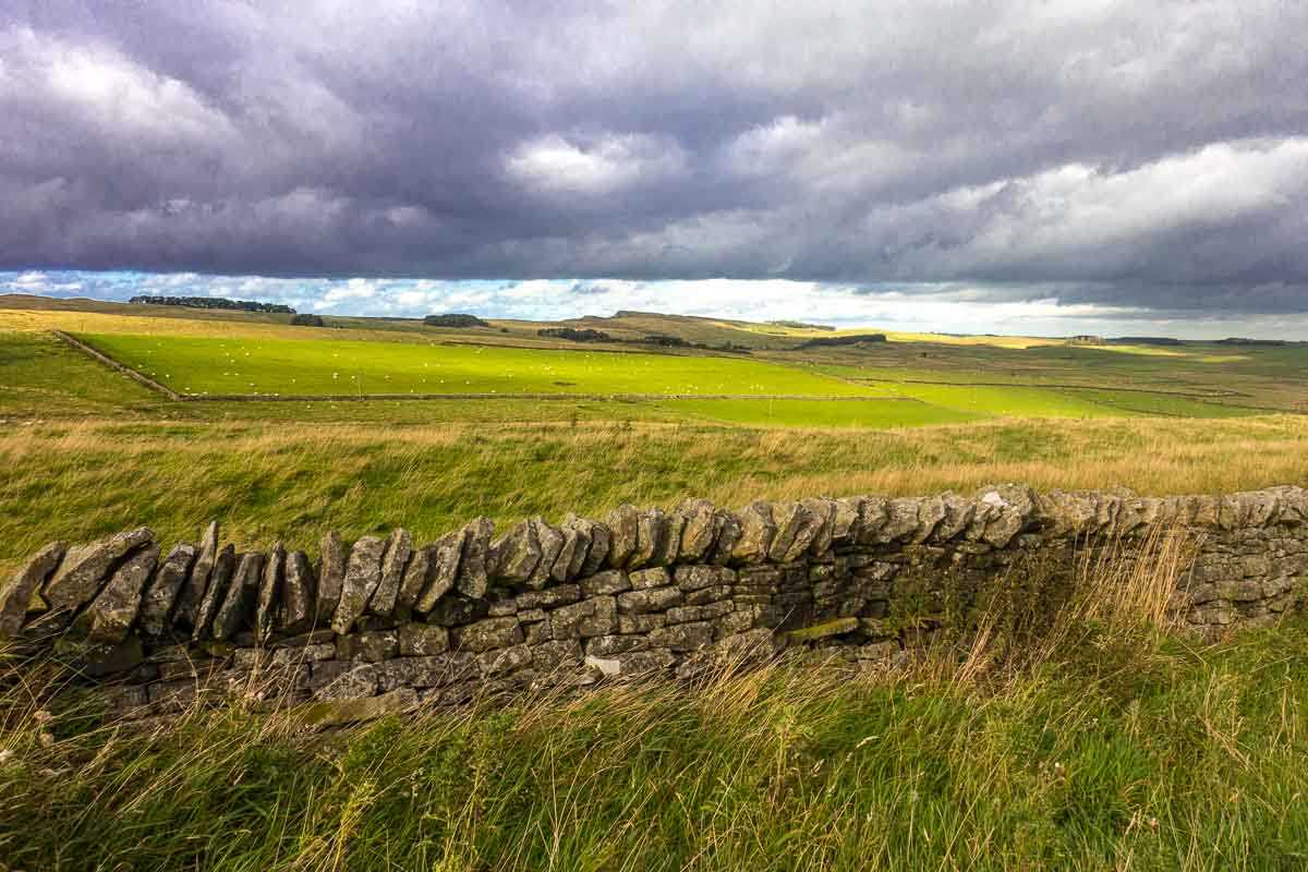
I admit that I was a little wary of taking an unguided bike trip all the way across England and then along the coast of Britain north to Edinburgh. Especially because Kris and I had tried to hike along the 85 miles of Hadrian's Wall a few years back–in late June–and were turned back by the British summer weather. In late June.
So nine days in mid-September was slightly more frightening, although I did look at the forecast and it promised to be relatively pleasant–or at least as pleasant as northern England ever gets. And, while I was going to be completely alone, I was going to be supported by a very well-regarded English cycling tour company called Saddle Skedaddle who were going to provide an e-bike, maps, directions, luggage transport, lodging arrangements, and general promises that they'd be there if I ran into any trouble. (More on that bit later.)
I had my choice of several tours offered by Skedaddle, but mostly because I was determined to see more of Hadrian's Wall, and to get to Edinburgh, where I'd never visited, I chose the Hadrian's Cycleway and Coast and Castles offering. It promised moderate difficulty, which I was happy to tackle on my e-bike. And in addition to satisfying the Roman history geek in me, I also relished an introduction to some English and Scottish castles and coastline.
Some posts on Travel Past 50 may contain affiliate links. If you buy something through one of those links, we may earn a small commission. As an Amazon associate, we earn from qualifying purchases.
I was only slightly worried that this tour, at nine days with no rest days, was going to be the longest bike tour I'd ever undertaken. And that, while I'd trained by biking around home for much of the summer, I was actually heading into this after not being on a bike for almost a month while I was hiking around Sweden and Spain.
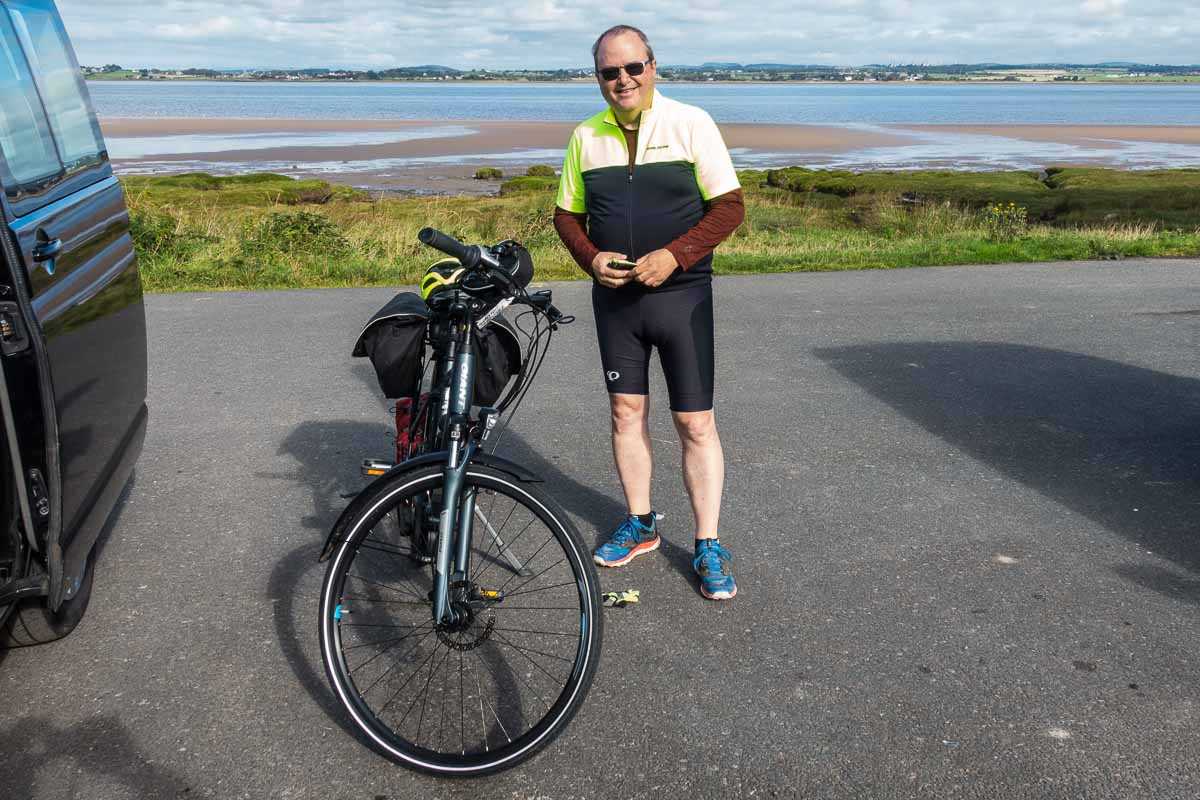
I wasn't completely without preparation however. The folks at Skedaddle kindly had a call with me before I left the States to prepare me for the encounter, and I flew into the starting point of Newcastle a day early to get a further briefing and all the documentation for the trip. Adam from Skedaddle met me at my hotel and we walked along the River Tyne to their offices where he gave me a thorough orientation, and where I tried on the bike to be sure it and I were compatible.
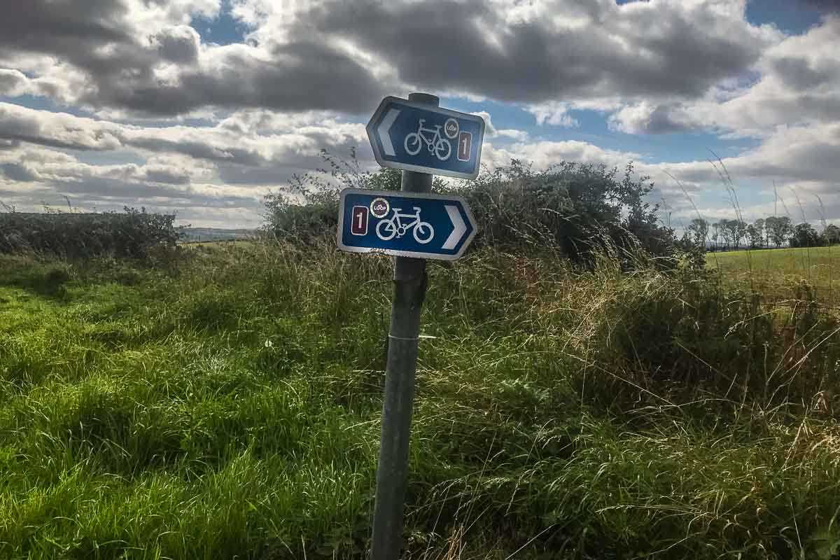
The documentation and directions consisted of bike route maps prepared by Sustrans (Sustainable Transportation) a British not-for-profit that has established bike routes all over Great Britain. Also attached were a daily set of directions from Skedaddle, and a specific map that led you to the night's lodging.
Finally, I did read Anthony Everitt's excellent biography of Hadrian. I figure if I'm going to spend days along one of the two major edifices that bear his name, I should probably have more than a passing acquaintance. (There's a lengthy Wikipedia article on Hadrian, if you're interested. If you're not that interested, here's the bare bones: Hadrian was the Roman Emperor from 117 to 138 A.D. He presided over the Roman Empire at its widest extent. He had the wall built all the way across the island of Britain beginning in 122. It took six years to complete.)
So, while I wasn't entirely confident, I was as ready as I was going to get.
Table of Contents
Day 1, Bowness on Solway to Gilsland, 67 km, 42 miles
I was picked up by a Skedaddle van in Newcastle and driven 80 miles to the west coast of Britain at Bowness on the Solway Firth. Here, I get my first view of Scotland across the wide Firth. The road followed the Firth on a gradual climb towards the city of Carlyle. The way provided absolutely no obstacle until getting to the busy city, where I promptly got lost.
This is where I realized that Sustrans' maps are not as detailed, especially in cities, as you might wish. And while Sustrans has posted numerous route signs, there is not necessarily a sign at every crossroads. So, there's ample opportunity to screw up. That's where Skedaddle's directions take over. For the most part, the directions are pretty good, but there are times when they could be better. The primary problem is that England generally regards street and major road signs as optional. And telling you which direction you are going? East, west, north, south? Never mind. So when, Skedaddle tells you to take the Newtown Road or B5307, good luck finding a sign that will tell you where those might be.
But, such is the charm of the Old World, no? I'd never given a lot of thought to the American infatuation with road signs, but I sure was missing it all of a sudden.
After asking directions of a few locals, and getting more hopelessly turned around in my attempt to get over the Eden River by some other means than a busy highway, I finally noticed a reference to a specific pub landmark. And, by pure chance, I was right in front of said Turf Pub, although I was pointed the wrong direction. As soon as I figured that out, I got back on the right track, found the remote bridge over the river and was back on my way.
Day 2, Gilsland to Corbridge, 61 km, 38 miles
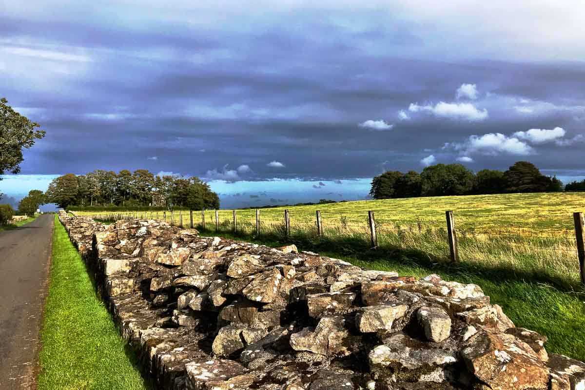
From a historical perspective, Day 2 was my favorite day of the entire trip because I got to visit the Roman archeological site at Vindolanda. As I approached Vindolanda, I unintentionally detoured from the route because 1) I missed a poorly marked turn, and 2) said to hell with it and continued along the wrong road to have a look at a castle. Then, I stupidly tried to push the bike up a very steep hill to see a well preserved section of the wall. As the hill became steeper and steeper, I became less stupid and backtracked down to the correct path. Although this detour was along the marked Hadrian's Wall path, this is where I really learned there's quite a difference between the walking route and the bike route. Don't make that mistake.
Vindolanda was a Roman fort town south of the Wall that was occupied for about 300 years. The site is connected to two excellent museums of Roman artifacts.
Before arriving at the Vindolanda site, a short detour off the Sustrans route led to the Roman Army Museum, which is situated next to one of the most complete sections of Hadrian’s Wall. This museum features several interesting artifacts, including the only surviving Roman Army helmet crest. The best part, though, was a 20 minute film dramatizing what life was like for soldiers on the northern frontier of the Empire. Hint: it wasn't easy.
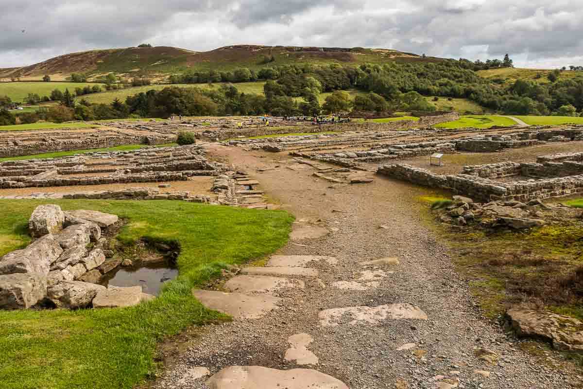
A bit further down the road are the Vindolanda ruins, where you can see archeologists digging at the extensive site. The site is quite large, and deep. It's estimated that, at the current rate of excavation, that the site won't be completely uncovered for more than 100 years.
The museum at Vindolanda itself, conserves and displays finds from the site. The museum is a walk down the hill from the archeology site, and includes full-sized reconstructions of a Roman temple, a Roman shop, and a Roman house. Exhibits in the museum include Roman boots, shoes, armor, jewelry and coins. Perhaps most interesting are photographic examples of writing tablets, and a small selection of the tablets themselves, on loan from the British Museum. Among those tablets are mundane military reports of the garrison's readiness. Most interesting, though, is the earliest known example of a woman's handwriting–a birthday party invitation from one Roman noblewoman to another. You can buy a card reproduction of the note in the gift shop.
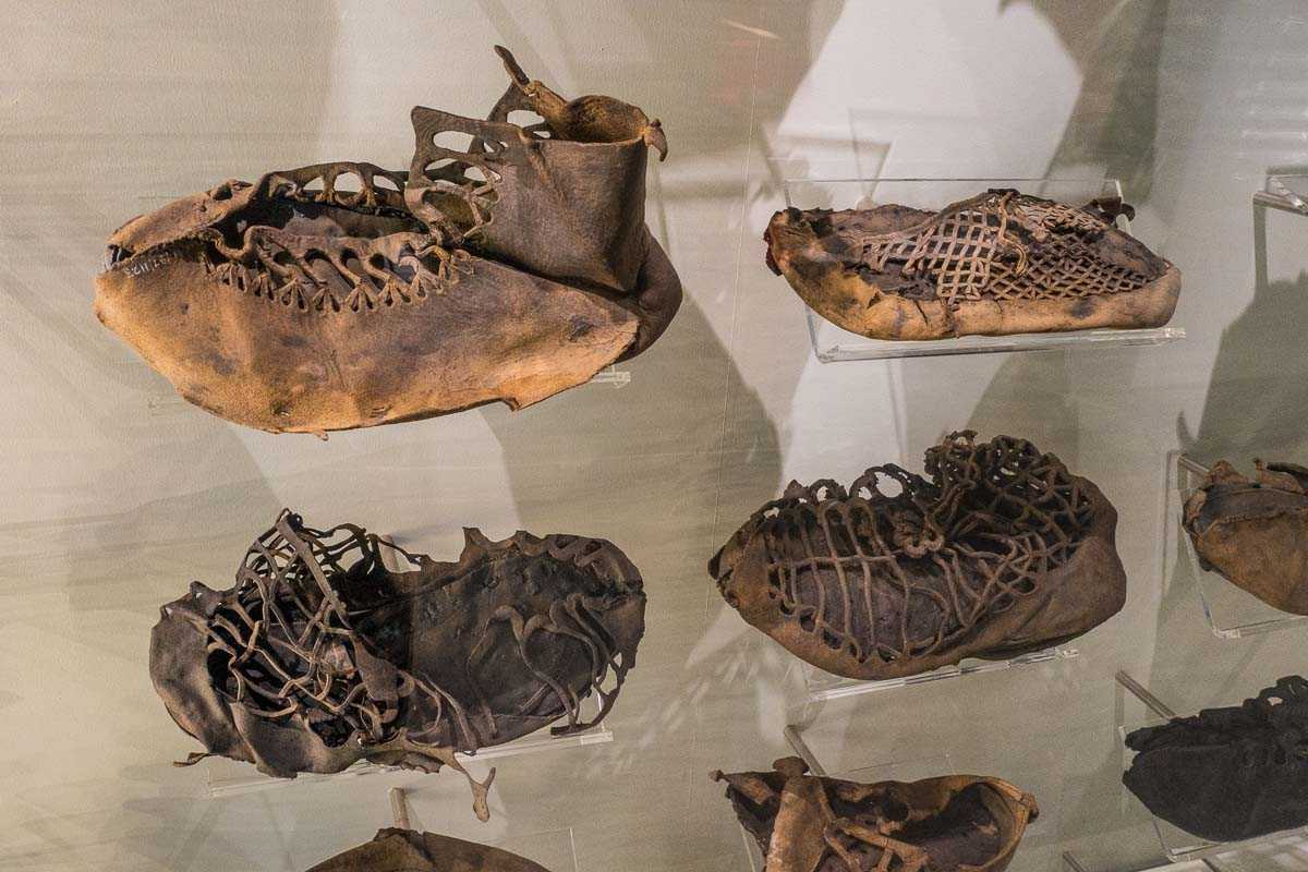
While the museum is not large, it houses a well-displayed and extraordinary collection of the exhumed evidence of daily Roman life. Honestly, I spent most of my time in front of the two large display cases of dozens of amazingly conserved examples of Roman footwear–everything from dainty women's slippers, children's booties, to rough soldiers' boots.
The other adventure of the day occurred just as I was heading out of the museum and up the very steepest hill of the entire tour. I made a very clumsy gear change, my foot slipped off the pedal, (in my defense, it was raining) and, making a long story short, jamming my foot back on the pedal broke the bike's chain.
Duh.
But, that experience allowed me to test the “emergency” phone number I'd got from Skedaddle. It took them a scant hour to get from Newcastle to the breakdown point (which allowed me to go back into the Museum and admire the shoes and tablets for another while, and get a coffee.) But after a 10 minute chain replacement I was on the way back up the hill to the highest point of Hadrian's Wall.
Good to know Skedaddle really does have your back.
Day 3, Corbridge to Tynemouth, 51 km, 32 miles
The third day was easiest of all, mainly because I was joined by Andrew Straw, one of the founders of Saddle Skedaddle. No worries about getting lost today.
It was mostly a downhill and very easy day mostly along the River Tyne, punctuated by a stop at Skedaddle's offices and their attached lunch restaurant. It was here I had a nice long conversation about Skedaddle with Andrew and was coincidentally introduced to Northumberland sausage and the famous English brown sauce, which, I was told, northerners put on everything.
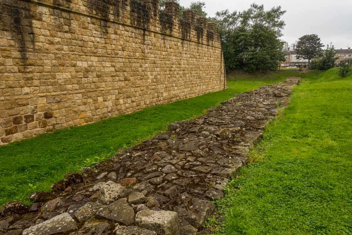
The day's cycling ended, not surprisingly, with Wall's End. It began to rain as we arrived, so I didn't stay for long, but it is a landmark worth noting. And yes, I had now biked all the way across England.
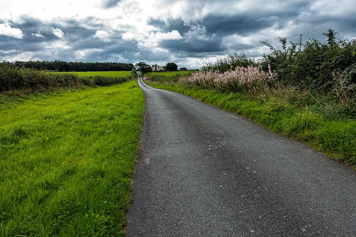
Day 4, Tynemouth to Warkworth, 72 km, 45 miles
The fourth day was marked mostly be getting totally lost not once, but twice. Again, I blame the cities, because the signage and directions are just not that good for getting you through the typical English unmarked maze that are its cities. In the first city of Blyth, the signs led you into an industrial area and then just stopped. After backtracking and passing the last sign I saw several times looking for which way to go, I broke out Google Maps, took a guess, and purely by accident came upon a Sustrans sign a few miles on.
But the next major town, ironically named, Amble, was the real treat. Again, I missed a sign somewhere and ended up on about an eight-mile detour along a bike path–just not the right bike path–that finally led me to a very busy highway toward my goal of Warkworth. At rush hour. Again, Google Maps to the rescue, and I was able to find a back way along small roads to Warkworth.
This is where I realized that I probably shouldn't bike across an entire country by myself because my mind tends to wander too much when I should have a sharp eye out for signs and landmarks. Generally, I rely on Kris's navigation expertise. She's really good at it. I can be good at it when I pay attention. However, Kris will tell you that paying attention is not my strong suit.
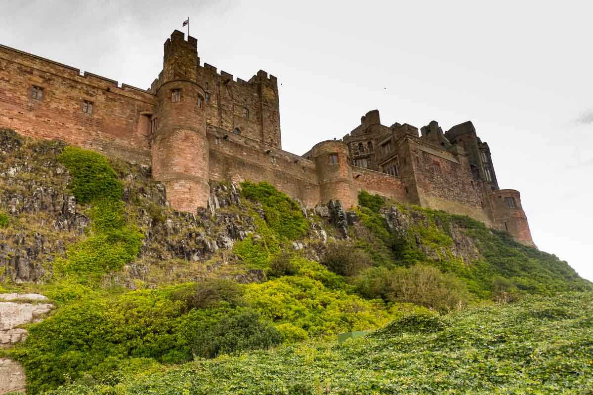
Day 5, Warkworth to Bamburgh, 49 km, 30 miles
This was a fairly short day and, consequently, I only made a couple of very slight navigation mistakes that were quickly corrected. I noted here that the Skedaddle-provided directions could be improved a little bit by telling you the upcoming turn distance. Is that left 200 yards or two miles? I adopted a strategy, a few days back, of just waiting until I saw a Sustrans sign directing me to the left. Sometimes that worked better than others.
While I'm on the topic of Sustrans signs, I ran into more than one occasion where I was confronted with signs literally pointing in both directions. When that happens (when you're coming back onto the path after a short detour as I often was) the ambiguous markings can inspire a chuckle. By the way, did I mention that carrying a compass is not a bad idea. I had one with me, which I used on more than one instance.
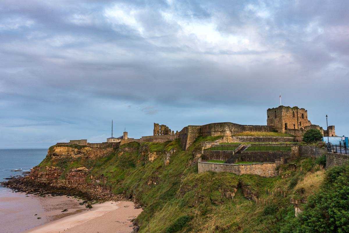
Day 6, Bamburgh to Berwick Upon Tweed 56 km, 35 miles
I haven't mentioned the wind yet. In this part of the world, it's your consistent companion. By consistent companion I mean that, no matter which direction you're traveling, it's blowing at about 30 miles per hour in your face. (Keep your lip balm handy.)
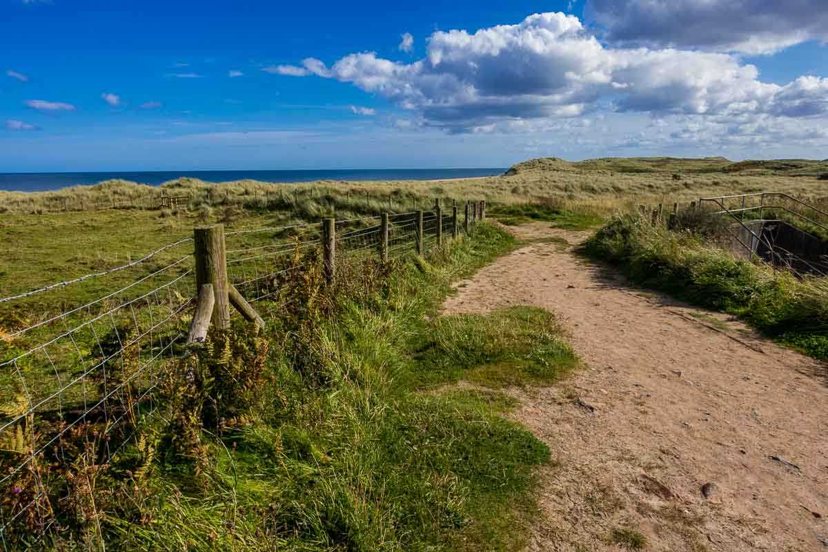
And when it's not blowing directly in your face, it's blowing from your left as you're moving cautiously along a very narrow unpaved path that's about three feet from a 70-foot cliff on your right down to the rocky sea coast. That's what a lot of Day 6 was about.
That and a long trip through a sheep and cow pasture where the path was a rut only a bit wider than a bike tire.
Both features necessitated a lot of getting off and walking the bike. In fairness, I should point out there was a “road alternative” route to Berwick. But, what fun is that, especially when contrasted with the imminent prospect of being dashed on the rocks below or being eyed by a bull whose pasture your passing through?
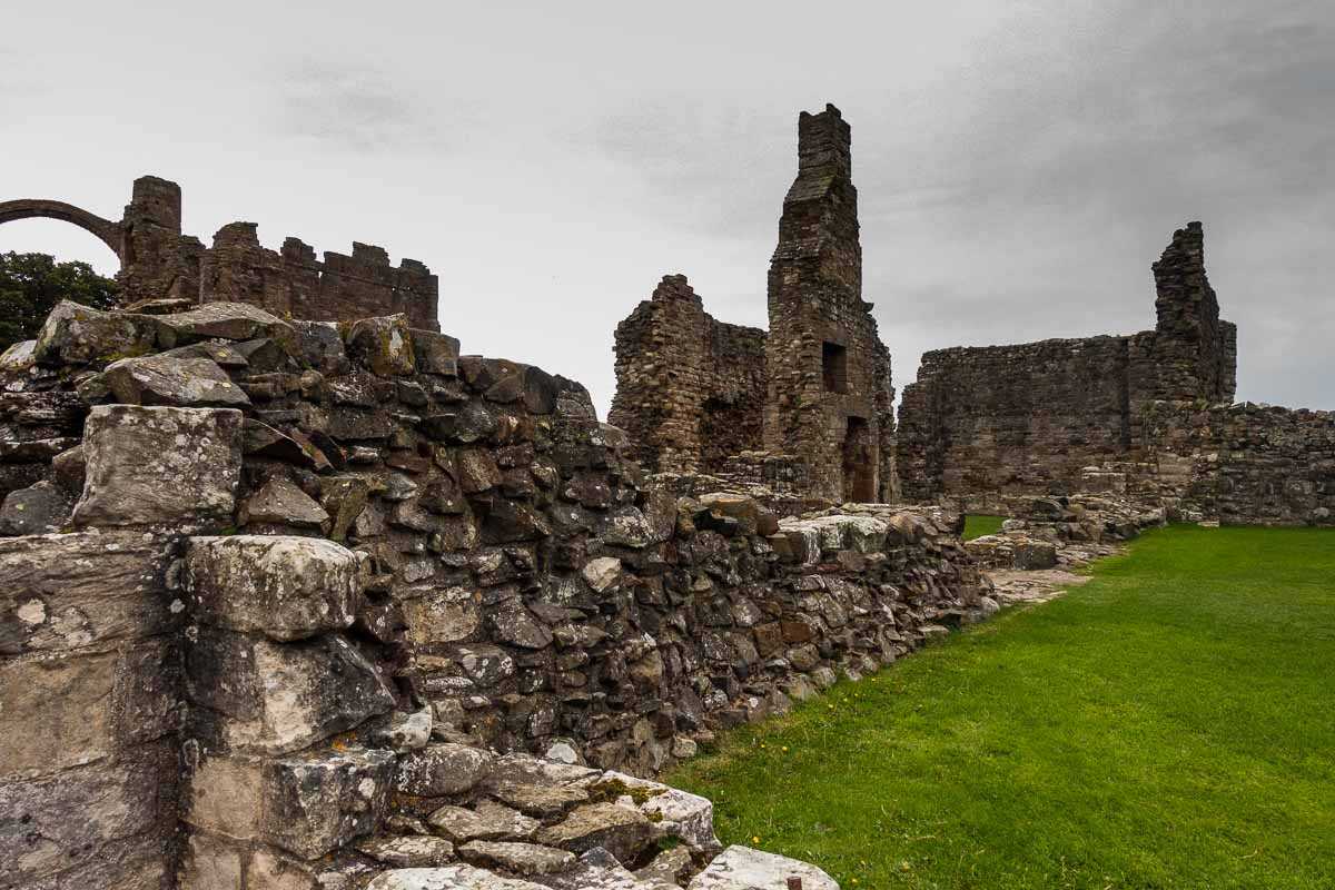
But the day's minor tribulations were rewarded by a seven-mile optional trip out a causeway to Holy Island. I admit I was intrigued by the fact that the causeway is flooded at high tide, and that I had time to bike quickly out to the island, spend an hour and a half touring a ruined abbey, and then busting butt back against the wind to the mainland. (Can you call Britain a mainland?) I am a sucker for ruins, and the Lindisfarne Priory on Holy Island is yet another of the impressive structures destroyed by Henry VIII during his battle against the church. I particularly like that after pulling down the abbeys, Henry often melted down the leaded stained glass to make bullets.
The wind blew hard in my face all the way back from the island, and I drained my bike's battery (and mine) getting back to land. Luckily not too far along the path was a golf course that cordially posted a sign welcoming hikers and bikers. A bowl of soup and a beer, and an hour's charge on the bike battery saved the day. Biking against that wind the rest of the way to Berwick without the electric assist would have been a killer.
Day 7, Berwick to Kelso, 52 km, 32 miles
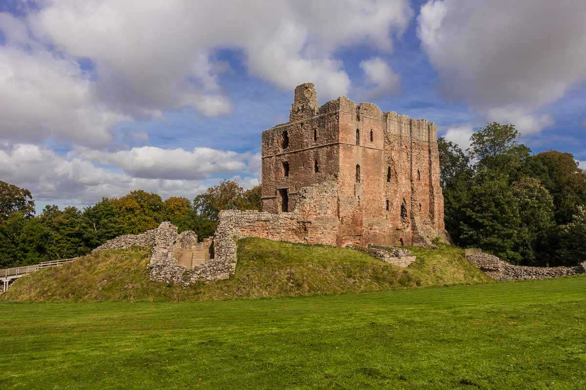
Today is the day I cross the River Tweed into Scotland (and later cross again back into England. And then back into Scotland.) It's a relatively easy day marked by no strange turnings, some lovely shady passages through deciduous forest and an interesting castle I could ride right up to.
Of course, like most of the castles and abbeys I've been passing, Norham Castle has been a ruin for a long time. But, there are some interesting signs on the grounds detailing the history of this 900-year-old outpost on the England-Scotland border. Without going into too much detail, the basic history is one of nearly constant conflict, as its location would suggest. Seems like if the Scots wanted to raid England, their first stop was Norham. And why not?
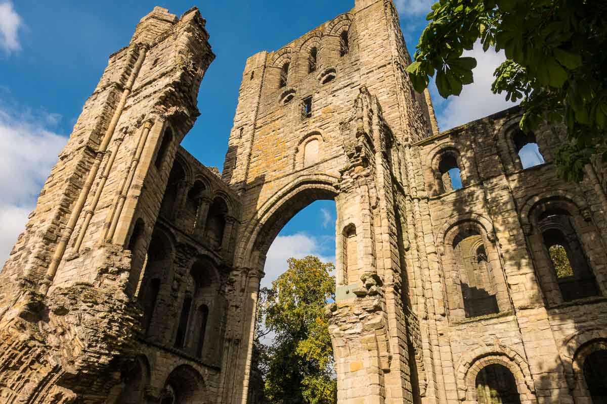
Arrival in the market town of Kelso was a treat. There's the Kelso Abbey, ruined like the others, but nevertheless still impressive. Most welcoming of all though, was a the local brewpub, Rutherford's, recommended by the owners of the bed and breakfast I was staying in. I was a bit early for the local crowd and so had the barman to myself for an hour of engaging conversation. The very reason you go to a pub.
Day 8, Kelso to Innerleithen, 57 km, 35 miles
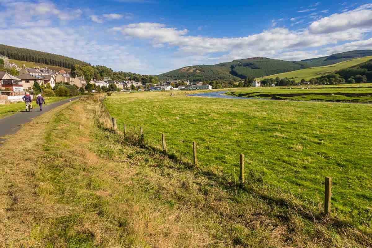
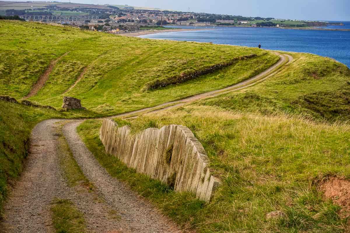
Another graceful day, mostly along the Tweed Valley. I passed through a couple of nice small towns and had only a few relatively easy climbs. At the end of the day, the path leveled out for the last couple of miles into Innerleithen. The highlight of today was being stopped by a Scottish couple just for a chat. We covered most every topic from dogs to Brexit to Donald Trump and had several good laughs. That's them walking away from me on the path in the photo above. A lovely break in the sometimes monotonous cycling.
Day 9, Innerleithen to Edinburgh, 66 km, 41 miles
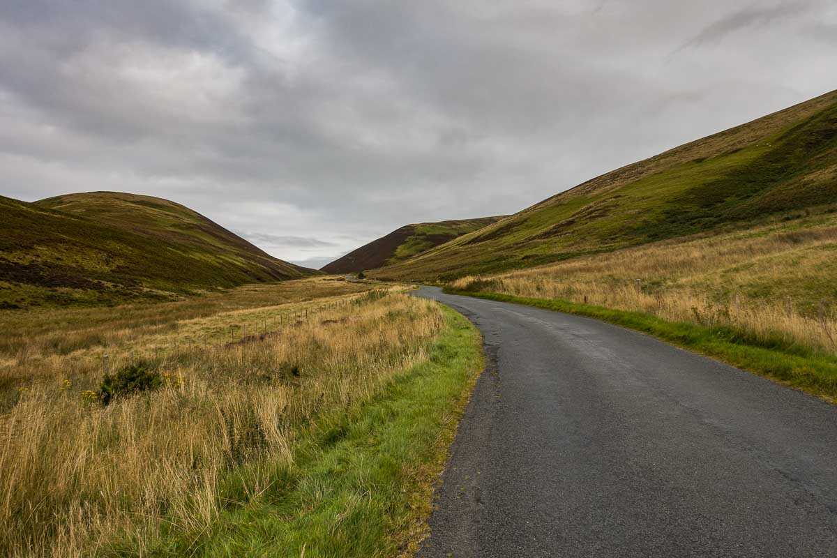
Can you say saving the best for last? I was dreading this day since starting out because I knew it was the longest day of the trip, that the first long stretch was 20 kilometers (12 miles) all uphill, and that it ended in another city where I knew I was probably going to get lost.
But, the climb up the Moorfoot Hills was gentle, mostly shielded from wind, and starkly beautiful. Yes, there was no respite on the climb other than the ones I took to steel myself for the next hill that kept appearing behind the one I was on. But there was an end to the climb after about two hours, and it was joyous.
There was the view of the path into Edinburgh that stretched out below me, and which for some reason I neglected to photograph. Probably because I just pointed the bike downhill and rode probably half an hour without having to pedal once until the road finally leveled out and took me into Edinburgh.
Only a slight hiccup as I lost my way for a bit in the town just before the big city. I straightened that out in short order and got to the edge of the city, where Google Maps again led me right where I was headed.
I dropped the bike to the waiting Skedaddle van, who then kindly took me to my hotel, where I showered and changed and headed for the closest pub where I congratulated myself with an 18-year-old Balvenie single malt.
When in Scotland…
Total, 9 days, 531 km, 330 miles
Saddle Skedaddle is a 25-year-old company that provides guided and self-guided tours mostly in Europe and South America–with a few oddball routes in places like Borneo, Jordan, Sri Lanka, and Ethiopia. Tours are offered in all grades of difficulty from easy to extremely challenging. (My trip was rated a 3 out of 5.) They organize tours for more than 5000 people per year.
The tours are also broken out by “themes” of Road Cycling, Leisure Cycling, Mountain Biking, Family Cycling, and Cycling Adventures that loosely correlate with degree of difficulty and cultural aspects of where you'll be biking.
The services offered include bike rental, both standard and e-bikes (for geezers like me). Movement of your luggage from lodging to lodging every day is part of the deal, too.
Saddle Skedaddle provided me the tour at no cost. There was no other compensation. They did not have any influence on what I wrote here.
In short, I'd highly recommend them for cycling in England, Scotland, or anywhere else. They're consummate pros, and other than a few navigation hiccups that could be tightened up a bit, I really have no complaints. I know they're working on an app right now that will improve navigation. I tested a beta version of the app on a few days and it worked quite well (although I really prefer Strava.)
My main suggestion for solving my navigation problems is don't do it alone. In fact, they made an exception to their usual policy to let me go it alone. Obviously, it's safer to travel with a partner. Especially one who can read a map better than I can.
Some other cycling suggestions
Read our post on Planning Your First Europe Bike Tour.
If you're undertaking a long bike tour, be sure to do some training before you go. Check out our suggestions for a training regimen, and a packing list for the trip.
Also, before you take on a long cycling trip, you might want to have a look at our favorite cycling gear and stock up on what suits you for your adventure.
You can read about our other cycling adventures in the Brittany region of France and the Puglia region of Italy.
I was thinking about biking as an alternative to walking the Hadrian’s Wall path until I got to the part about the wind. Was the electric bike able to assist you sufficiently up big hills?
Th e-bike made the hills much more manageable. But, for the most part the hills weren’t too bad. Except for right in the middle of Britain, it’s pretty flat.